
Photos
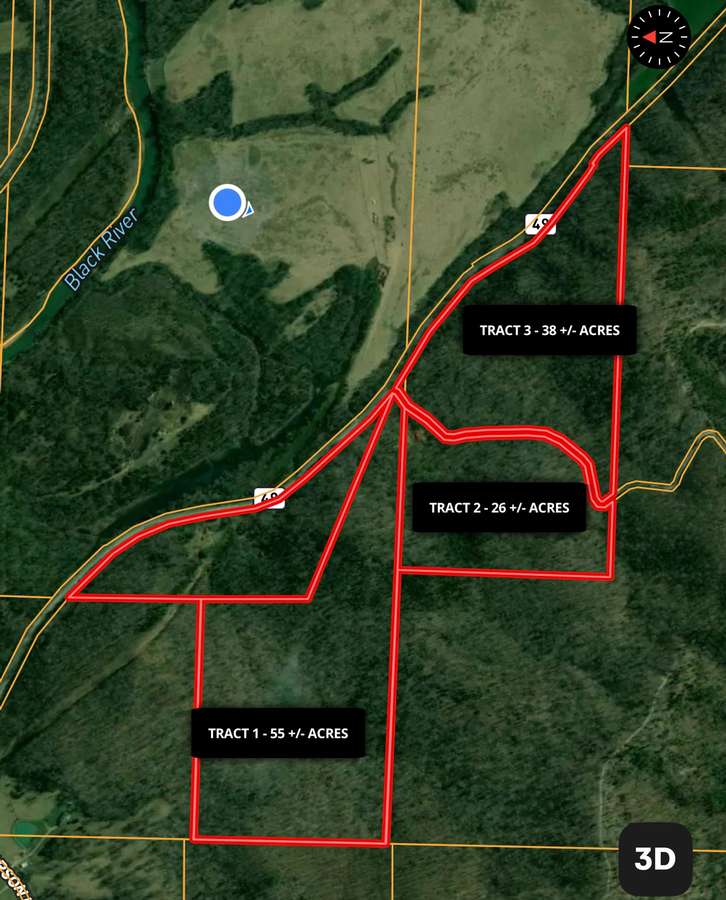
Map
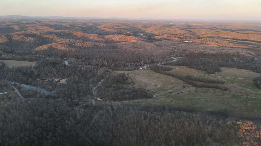
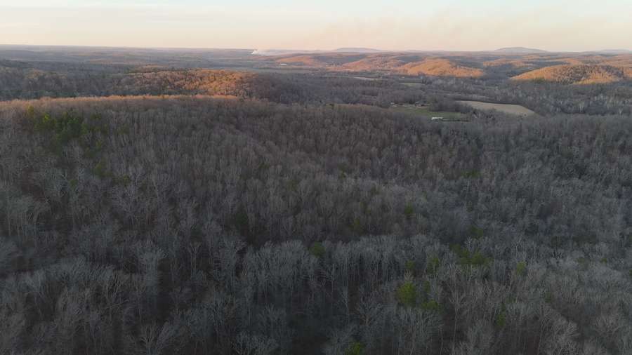
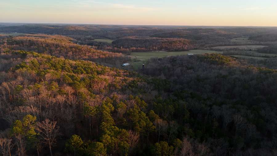
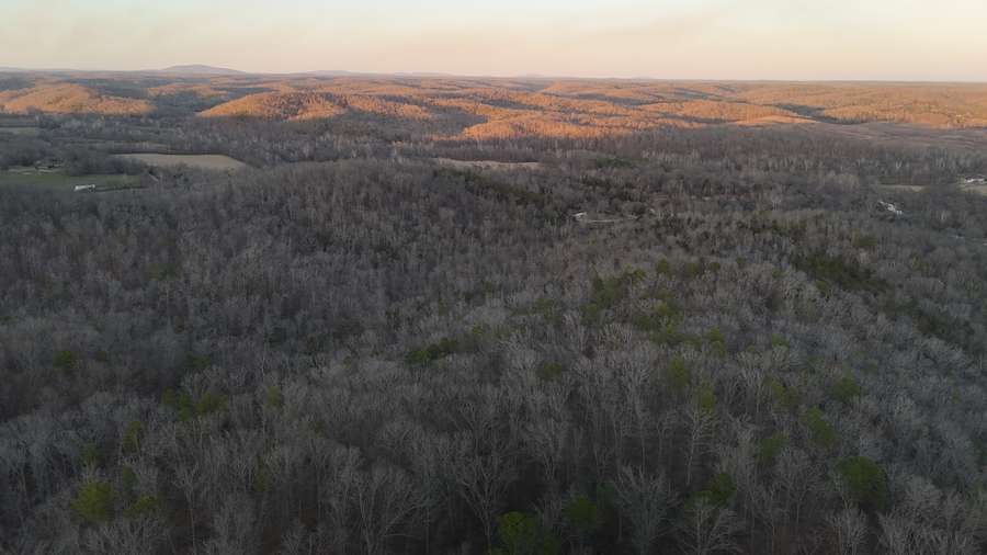
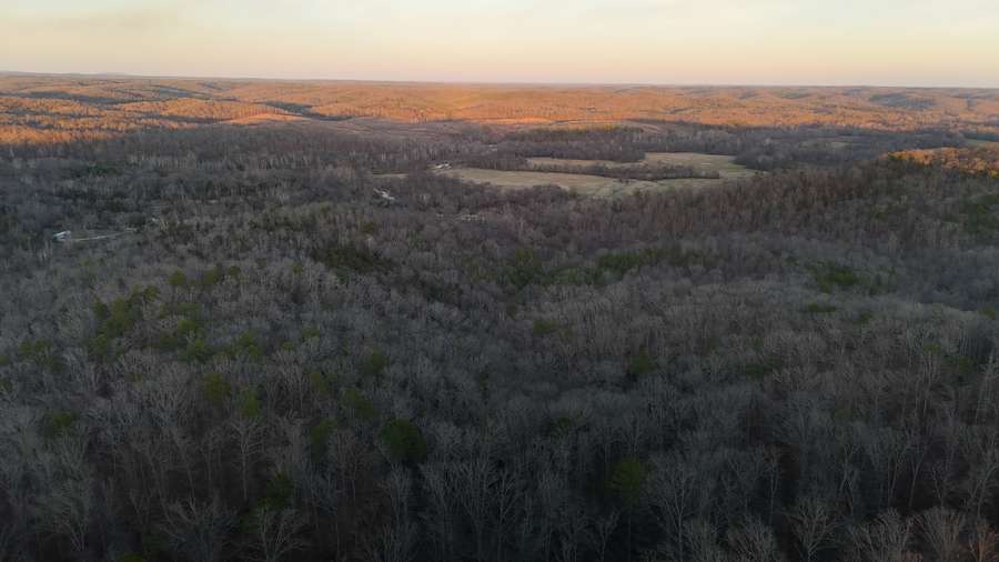
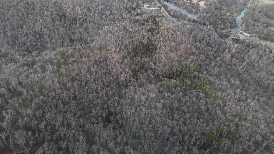
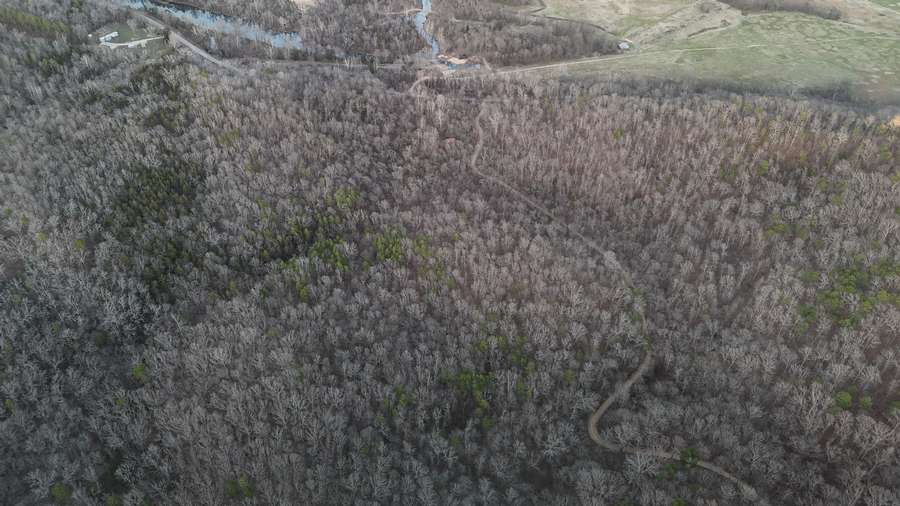
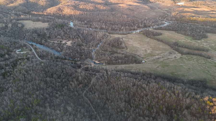
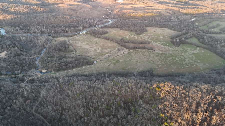
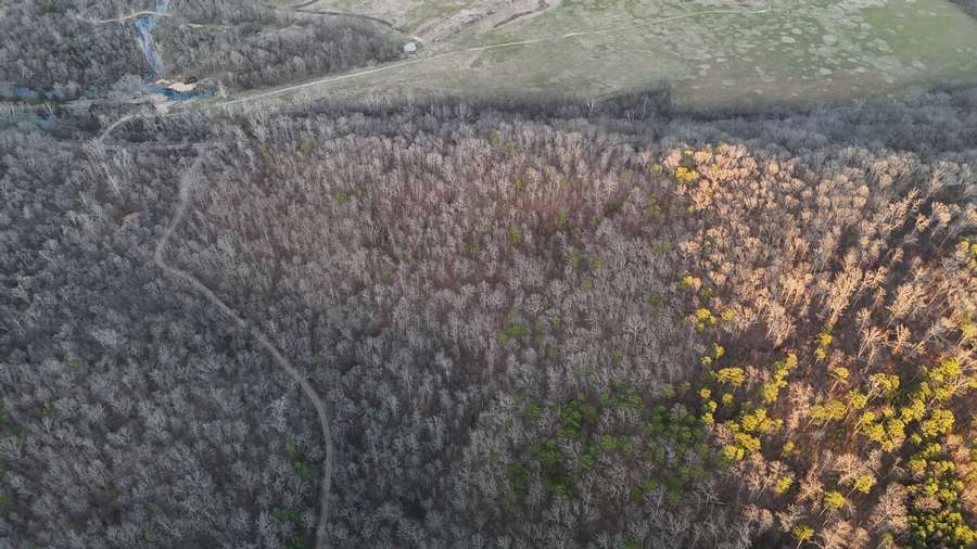
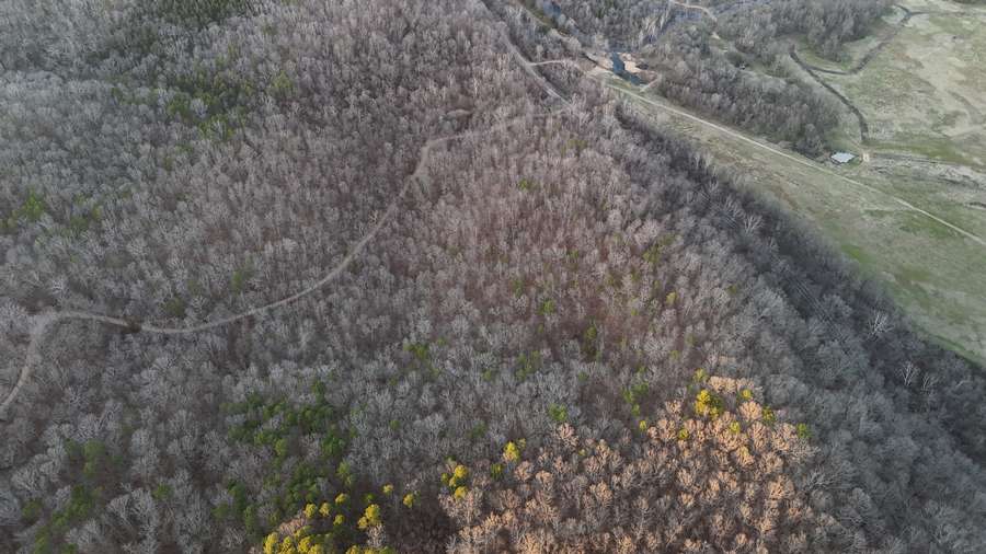
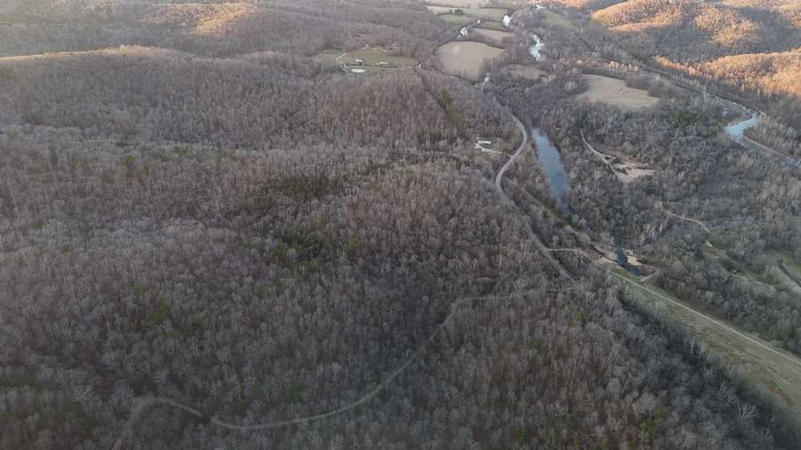
Aerial
Property Details
Acreage:
26.0000
Price:
$110,000.00
Address:
00 North & South of CR 441
Mill Spring, MO 63925
County:
Coordinates:
37.028584 / -90.667799
Price Per Acre:
$4,230.77
Property Type:
Ryan McKinley: Broker Associate / Auctioneer

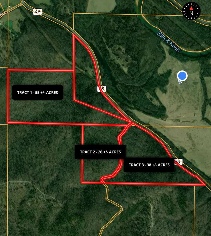
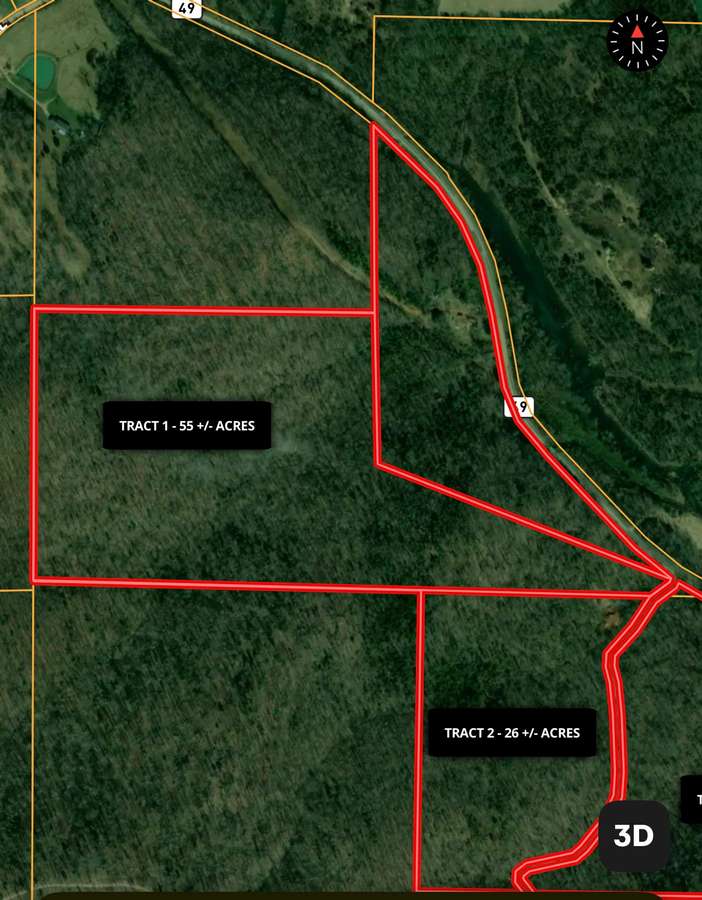
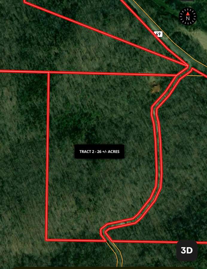
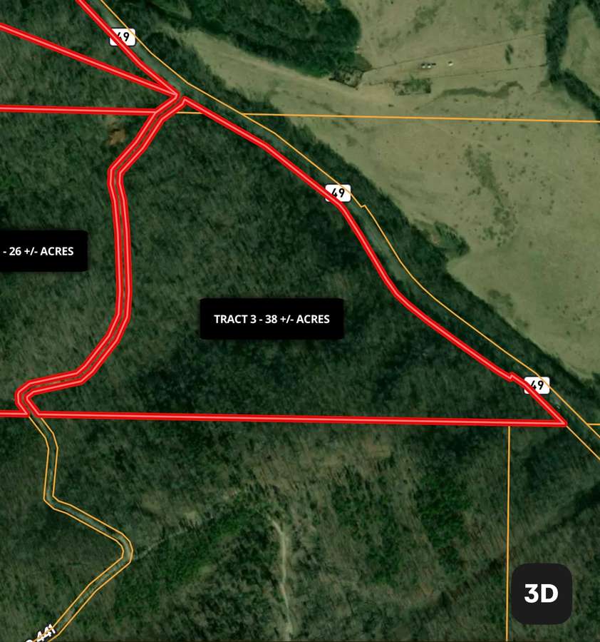
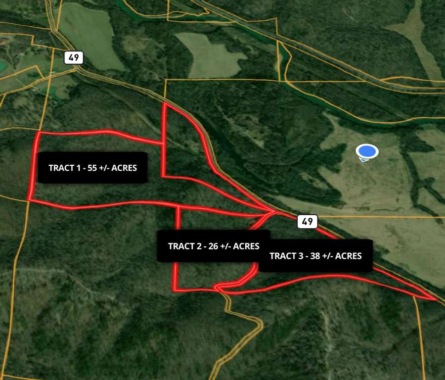
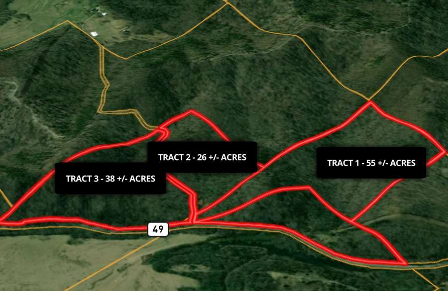
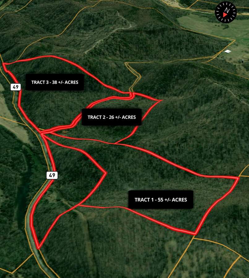
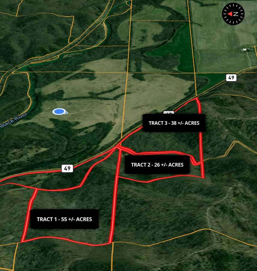
120 +/- Acres | 3 Tracts | Wayne County, Missouri Mill Spring • Ozark Mountains • Mark Twain National Forest Border Located approximately 3 miles south of Mill Spring, Missouri, this exceptional 120 +/- acre offering is divided into three tracts and sits on the southern edge of the St. Francis Mountain Range in the heart of the Ozark Mountains. The property lies west of Highway 49 and is largely bordered by the Mark Twain National Forest, creating a rare opportunity for privacy, recreation, and long-term land ownership surrounded by protected land. The land features gently rolling to rugged Ozark timberland with mature woods, abundant wildlife, and classic mountain scenery. Electric power is available, and access is excellent with Highway 49 frontage as well as county road access. County Road 441 serves the property and is a dead-end road leading only to a cattle farm, ensuring no through traffic and a quiet, secluded setting. The Black River is close by, and the beautiful Bunyard Spring—one of the region’s most scenic natural springs—flows under Highway 49 adjacent to the property, adding to the area’s natural appeal and recreational value. Tract Breakdown: • Tract 1 – 55 +/- Acres Features a north boundary adjoining a private landowner, with the remaining borders joining the Mark Twain National Forest. Ideal for a private homestead, hunting base, or recreational retreat with unmatched seclusion. • Tract 2 – 26 +/- Acres A versatile smaller tract well-suited for a cabin site, recreational use, or investment, with easy access and close proximity to national forest land. • Tract 3 – 38 +/- Acres Excellent timber and recreational ground with strong access, abundant wildlife, and direct connection to the surrounding Ozark landscape. All tracts offer outstanding hunting, hiking, and outdoor recreation, with thousands of acres of national forest literally at your doorstep. Whether you are looking for a private retreat, hunting property, timber investment, or a combination of all three, this property delivers location, access, and natural beauty in one of southeast Missouri’s most desirable rural settings. All final acreage to be determined by survey.